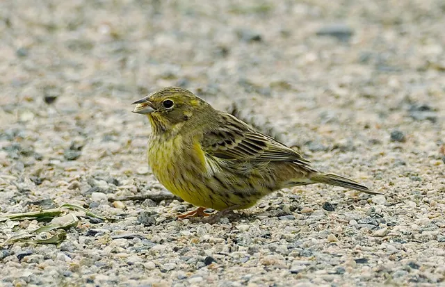
Yellowhammer (Emberiza citrinella)Where and when to see it in the UK
Resident · reporting peaks April to July · Old World Buntings · BOU category AF
Peak months
Contains OS data © Crown copyright and database right 2026 (grid squares, place names from OS Open Names). Northern Ireland place names: OSNI Open Data, OGL v3.0. County and country boundaries: Office for National Statistics, Open Government Licence v3.0. Coastline: Natural Earth. Bird records from the data partners listed here.
Yellowhammer has been recorded in 2,035 of the 2,971 10 km squares covering UK land (68%) in records to 2026. Resident in the UK. Its strongest squares are in England, Scotland and Wales. Reporting peaks in April to July.
Conservation status: Least Concern (IUCN Red List, LC)
View on the IUCN Red List- Very high
- 31% or more of visits
- High
- 12% to 31%
- Moderate
- 4% to 12%
- Low
- under 4%
- Surveyed, not recorded
- at least 20 qualifying visits, no record
- Insufficient records
- too few visits to say
- Lighter fill
- Few visits, lower confidence
- Small dot
- Occasional: a single record, or out of season
Relative to this species' best squares (how classes are calculated)
Seasonality
| Month | Relative to peak | Share of visits | Typical class |
|---|---|---|---|
| January | 51% | 5% | Low |
| February | 62% | 6% | Very high |
| March | 82% | 7% | Very high |
| April | 88% | 8% | Very high |
| May | 96% | 9% | Very high |
| June | 100% | 9% | Very high |
| July | 92% | 8% | Very high |
| August | 46% | 4% | Very high |
| September | 33% | 3% | Low |
| October | 55% | 5% | Low |
| November | 53% | 5% | High |
| December | 48% | 4% | Very high |
Squares with the highest reporting rate in April
| Square | Where | Share of visits | Class |
|---|---|---|---|
| C81 | Causeway Coast and Glens, Northern Ireland | 100% | Very high |
| C82 | Causeway Coast and Glens, Northern Ireland | 100% | Very high |
| C91 | Causeway Coast and Glens, Northern Ireland | 100% | Very high |
| J15 | Armagh City, Banbridge and Craigavon, Northern Ireland | 100% | Very high |
| J38 | Antrim and Newtownabbey, Northern Ireland | 100% | Very high |
| J44 | Newry, Mourne and Down, Northern Ireland | 100% | Very high |
| J57 | Ards and North Down, Northern Ireland | 100% | Very high |
| J64 | Ards and North Down, Northern Ireland | 100% | Very high |
| J66 | Ards and North Down, Northern Ireland | 100% | Very high |
| J67 | Ards and North Down, Northern Ireland | 100% | Very high |